Passing Hails
- Full Text
- Passing Hails
Inland seas
For years I've been sailing
Though I never seen the sea
The Great Lakes and their shipping
They are sea enough for me.
I've sailed these lakes in summer
When the soft sou'westers blow
I've sailed them in the winter
When near twenty-two below
I've sailed on golden pathways
Which the moon beams laid before
I've weathered many blizzards
Mid a wild nor'easter roar
I've shot St. Lawrence's rapids
And I've grounded at the Soo
When Welland's lock were opened
I made sure my boat first through
From Quebec to Fort William
From Chicago to Duluth
Knew every light and channel
Fore I'd cut a wisdom tooth
I've lain to of Point Edward.
When the blinding was thick'
While Thunder Cap and Pelee
Have taught me many a trick
Ahoy! You salt-sea sailors!
You, who boast about the sea
if you would know real sailing
Sail these inland seas with meT. B. Gleave
Quiz as to where Bear Creek is produced a spate of answers, plus the above very good poem from a High Park neighbor Mr. Gleave, of Alhambra avenue, whose two books, “Vistas Gray and Gay” and “Here's to Happiness,” have been published most attractively by W.T. Kirby Company, and met a good reception. If “Inland Seas” is autobiographical Mr. Greave ought to know the compass course to Bear Creek.
Capt. Walter Kirk, of Cat Hollow, came across with latitude and longitude for Bear Creek mouth right out of the box. Dare say he could find it with his eyes shut, counting the engine revs and using the hand lead. He's a sailor.
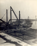
H.C. Joselin 158 Macpherson avenue, and a very reasonable guess that Bear Creek was the Etobicoke, and the Long dock mentioned was the one at Long Branch, where steamers used to land excursions years ago. Various members of the Smith family, who seem to have spread all over Lake Ontario and the Bay of Quinte, hazarded guesses all based on the assumption that Bear Creek was an alias or disguised name. The most interesting was that the photo shown was a section of one of the lagoons at Toronto Island, probably based on the small craft and the high water.
The answer-all wrong but Capt Kirk's emphasize the general similarity of lagoons and creek mouths and such natural harbors and of the small craft that frequent them. There are few distinctive or purely local types left of this lake.
Bear Creek is a real place, and that is its real name, and the only one the writer has ever heard for it. It is 107 miles ESE of Toronto, on the south shore of Lake Ontario some miles east of the port of Rochester, better known as Charlotte, and five miles west of Pultneyville. Furnaceville is the real name of a real village, two miles inland from Bear Creek mouth. The “long pier” was known as Dan Grant's.
Don't attempt Bear Creek in the dark or in anything but smooth water. At times it is completely barred over with gravel piled on grounded tree trunks. This year's all time high water won't last forever. On our island shore Monday night even after heavy rain Sunday it was noticeable that the weed line on the rocks was showing inches above the water level. An ebb has started. We read recently that between and the lake levels rose seven feet above what they had been and the plague of fever and ague followed in Ontario. What goes up must come down. Diversion of a watershed like the Ogoki will have some permanent effect on lake levels below-but we repeat, high water won't last forever.
- Media Type
- Newspaper
- Text
- Item Type
- Clippings
- Date of Publication
- 30 Aug 1947
- Collection
- Richard Palmer
- Language of Item
- English
- Geographic Coverage
-
-
New York, United States
Latitude: 43.27645 Longitude: -77.27749 -
New York, United States
Latitude: 43.25229 Longitude: -77.27388
-
- Creative Commons licence
 [more details]
- Copyright Statement
- Copyright status unknown. Responsibility for determining the copyright status and any use rests exclusively with the user.
- Contact
- Maritime History of the Great LakesEmail:walter@maritimehistoryofthegreatlakes.ca
Website:


