Highlights from the collection
Maps and Charts
Pages
Traditional photographsEngravingsStereoviewsChromolithographsPostcardsMaps and ChartsMagic Lantern SlidesPiano Sheet MusicBooksContributedDigital Photographs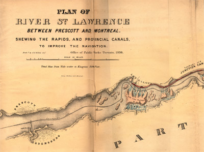
Plan of River St. Lawrence Between Prescott and Montreal 
An extraordinary chart, the original of which is nearly nineteen feet long, developed to illustrate both the steamboat tracks down the rapids, the canals, and the various aids to navigation on the river. The plan was so large that a series of printed sheets had to be glued together to assemble the final plan.
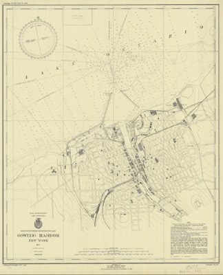
Oswego Harbor, New York, 1943
This example from Oswego is part of a huge collection of American charts digitized by NOAA.
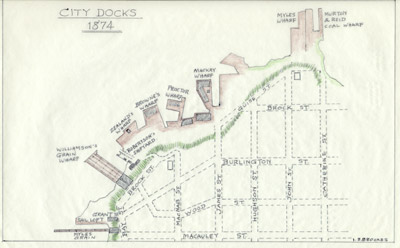
Plan of Hamilton Docks, 1874
Here is an example of charts that have appeared in the books that are featured in the collection. This is an example drafted by Ivan Brookes for his History of Hamilton Harbour
