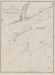
Lake Huron. Sheet III [Georgian Bay, 1822]
Description
- Creator
- Bayfield, Henry W., Surveyor
- Media Type
- Image
- Item Type
- Charts
- Notes
- Lake Huron.
Sheet III
The Soundings are in feet
Surveyed by Capt'n H. W. Bayfield, R. N. 1822
London Published according to Act of Parliament at the Hydrographical Office of the Admiralty, 29th Sept. 1828.
J. & C. Walker Sculpt - Publisher
- Great Britain. Admiralty. Hydrographic Office
- Place of Publication
- London, Eng.
- Date of Original
- pub. 29 September 1828
- Date Of Event
- survey: 1822
- Language of Item
- English
- Geographic Coverage
-
-
Ontario, Canada
Latitude: 45.25011 Longitude: -80.74973
-
- Creative Commons licence
 [more details]
- Copyright Statement
- Copyright status unknown. Responsibility for determining the copyright status and any use rests exclusively with the user.
- Contact
- Maritime History of the Great LakesEmail:walter@maritimehistoryofthegreatlakes.ca
Website:

![Lake Huron. Sheet III [Georgian Bay, 1822]](https://images.MaritimeHistoryoftheGreatLakes.ca/images/MHGL000122592.jpg)

