Admiralty Charts of the Great Lakes
Records
Results
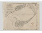
- Plan of Toronto Harbour, Lake Ontario. Surveyed under the Direction of Capt'n W. F. W. Owen, R. N. By Lieu't now Commander H.W.Bayfield, R. N. Drawn by Geo. D. Cranfield, Lieu't 90th L't. Inf'y The TPlan of Toronto Harbour, Lake Ontario. Surveyed under the Direction of Capt'n …
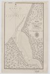
- A Survey of the River Detroit from Lake Erie to Lake St. Clair by Capt. W. F. W. Owen & Assistants in 1815A Survey of the River Detroit from Lake Erie to Lake St. …
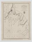
- Grand River Entrance by Messrs. Harris & Vidal Marine Survey Department under Capt. W. F. W. Went, R. N. November 1815 Lake Erie Quebec 24 June 1816 G. Nicols Lt Col. R. EngineersGrand River Entrance by Messrs. Harris & Vidal Marine Survey Department under …
- Survey of the River Niagara. Made under the direction of Capt'n W'm Fiz W'm. Owen, in the Year 1817 The Soundings are laid down in Feet -- Inset -- Survey of the entrance of the River Niagara from LaSurvey of the River Niagara. Made under the direction of Capt'n W'm …
- Lake Erie: Inner and Outer Bays of Long Point By Lieu't Henry W. Bayfield, R. N. in 1818 The Soundings are in Feet London Published according to Act of Parliament at the Hydrographical Office of theLake Erie: Inner and Outer Bays of Long Point By Lieu't Henry …
- Coverage on the chart ranges from the Ducks in the northwest to Collins Inlet in the northeast to Chiefs Point on the Lake Huron side of the Bruce Peninsula and Lions Head on the Georgian Bay sideCoverage on the chart ranges from the Ducks in the northwest to …
- Western shore of Lake Huron from roughly White Rock Point to Middle Island, including Saginaw Bay and Thunder BayWestern shore of Lake Huron from roughly White Rock Point to Middle …
- Chart extends from Lake George and Sugar Island in the northwest, Neebish Island and Mud Lake in the south west, St. Joseph Island on the south and east to the bay that would eventually front Bruce MChart extends from Lake George and Sugar Island in the northwest, Neebish …
- Chart of Part of the North Coast of Lake Superior from Small Lake Harbour to Peninsula Harbour Surveyed by Lieu't Henry W'y Bayfield, R. N. assisted by Mr. Philip E. Collins, Mid'n 1823 NB The SoundsChart of Part of the North Coast of Lake Superior from Small …
- Chart of that Part of the North Coast of Lake Superior that includes Neepigon [Nipigon] & Black Bays Surveyed by Lieu't Henry W'y Bayfield, R. N. and his assistant Mr. Philip E. Collins, Mid., R. N.Chart of that Part of the North Coast of Lake Superior that …
- A Survey of St. Mary's River From the Falls to Lake George by Lieu't Henry W'y Bayfield R. N. and Mr. Philip E. Collins Mid'n and Assistant 1825 NB The Soundings are in Feet. London Published accordiA Survey of St. Mary's River From the Falls to Lake George …
- Lake Huron Rattle Snake Harbour by Lieut. H. W. Bayfield R. N. NB The sounds are in feet Variation 1861 increasing 4' annually London Published according to Act of Parliament at the Hydrographical OfLake Huron Rattle Snake Harbour by Lieut. H. W. Bayfield R. N. …
- A Survey of Lake Erie; in the Years 1817 & 1818 By Lieu't Henry W. Bayfield, R. N. All Soundings are in feet N.B. The depth of water varies, according as the seasons are wet or dry; the maximum beingA Survey of Lake Erie; in the Years 1817 & 1818 By …
- Bayfield would appear to have gotten his distances wrong, as this appears to be the mouth of Eighteen Mile Creek.Bayfield would appear to have gotten his distances wrong, as this appears …
- Lake Huron. Port Collier by Lieut H. W. Bayfield R. N. 1817 NB The Sounding are in feet London Published according to Act of Parliament at the Hydrographical Office of the Admiralty, 31th May 1828. JLake Huron. Port Collier by Lieut H. W. Bayfield R. N. 1817 …
- Chart of southern Lake Huron, from Point aux Barques in the center west, to Fort Gratiate [Gratiot] and Point Edward in the south to Chiefs Point in the northeast.Chart of southern Lake Huron, from Point aux Barques in the center …
- Lake Huron. Sheet III The Soundings are in feet Surveyed by Capt'n H. W. Bayfield, R. N. 1822 London Published according to Act of Parliament at the Hydrographical Office of the Admiralty, 29th Sept.Lake Huron. Sheet III The Soundings are in feet Surveyed by Capt'n …
- Chart of eastern Lake Superior from Sand River in the southwest to the Falls of St. Mary's (Sault Ste Marie) to the Slate Islands in the north west. An inset shows the Hudson Bay Company post and theChart of eastern Lake Superior from Sand River in the southwest to …
- Lake Superior. Sheet 2 The Soundings are in Feet London Published according to Act of Parliament at the Hydrographical Office of the Admiralty, 1st Sept. 1828. J. & C. Walker SculptLake Superior. Sheet 2 The Soundings are in Feet London Published according …
- Chart of Part of the North Coast of Lake Superior from Small Lake Harbour to Peninsula Harbour Surveyed by Lieu't Henry W'y Bayfield, R. N. assisted by Mr. Philip E. Collins, Mid'n 1823 NB The SoundiChart of Part of the North Coast of Lake Superior from Small …


![A Survey of the River Detroit [1815] A Survey of the River Detroit [1815]](https://images.MaritimeHistoryoftheGreatLakes.ca/images/MHGL000122577t.jpg)
![Grand River Entrance [1815] Grand River Entrance [1815]](https://images.MaritimeHistoryoftheGreatLakes.ca/images/MHGL000122578t.jpg)
![Survey of the River Niagara [1817] Survey of the River Niagara [1817]](https://images.MaritimeHistoryoftheGreatLakes.ca/images/MHGL000122579t.jpg)
![Lake Erie: Inner and Outer Bays of Long Point [1818] Lake Erie: Inner and Outer Bays of Long Point [1818]](https://images.MaritimeHistoryoftheGreatLakes.ca/images/MHGL000122580t.jpg)
![Lake Huron: Sheet II [1822] Lake Huron: Sheet II [1822]](https://images.MaritimeHistoryoftheGreatLakes.ca/images/MHGL000122581t.jpg)
![Lake Huron. Sheet IV [1822] Lake Huron. Sheet IV [1822]](https://images.MaritimeHistoryoftheGreatLakes.ca/images/MHGL000122582t.jpg)
![A Survey of St. Joseph's North Channel, Lake Huron [1822] A Survey of St. Joseph's North Channel, Lake Huron [1822]](https://images.MaritimeHistoryoftheGreatLakes.ca/images/MHGL000122583t.jpg)
![Chart of Part of the North Coast of Lake Superior from Small Lake Harbour to Peninsula Harbour [1823, 1861] Chart of Part of the North Coast of Lake Superior from Small Lake Harbour to Peninsula Harbour [1823, 1861]](https://images.MaritimeHistoryoftheGreatLakes.ca/images/MHGL000122584t.jpg)
![Chart of that Part of the North Coast of Lake Superior that includes Neepigon & Black Bays [1823] Chart of that Part of the North Coast of Lake Superior that includes Neepigon & Black Bays [1823]](https://images.MaritimeHistoryoftheGreatLakes.ca/images/MHGL000122585t.jpg)
![A Survey of St. Mary's River From the Falls to Lake George [1825] A Survey of St. Mary's River From the Falls to Lake George [1825]](https://images.MaritimeHistoryoftheGreatLakes.ca/images/MHGL000122586t.jpg)
![Lake Huron. Rattle Snake Harbour [1828, 1863] Lake Huron. Rattle Snake Harbour [1828, 1863]](https://images.MaritimeHistoryoftheGreatLakes.ca/images/MHGL000122587t.jpg)
![A Survey of Lake Erie [1817-18] A Survey of Lake Erie [1817-18]](https://images.MaritimeHistoryoftheGreatLakes.ca/images/MHGL000122588t.jpg)


![Lake Huron. Sheet V [1822] Lake Huron. Sheet V [1822]](https://images.MaritimeHistoryoftheGreatLakes.ca/images/MHGL000122591t.jpg)
![Lake Huron. Sheet III [Georgian Bay, 1822] Lake Huron. Sheet III [Georgian Bay, 1822]](https://images.MaritimeHistoryoftheGreatLakes.ca/images/MHGL000122592t.jpg)
![Lake Superior. Sheet III [1823-24] Lake Superior. Sheet III [1823-24]](https://images.MaritimeHistoryoftheGreatLakes.ca/images/MHGL000122593t.jpg)
![Lake Superior. Sheet 2 [1823-24] Lake Superior. Sheet 2 [1823-24]](https://images.MaritimeHistoryoftheGreatLakes.ca/images/MHGL000122594t.jpg)
![Chart of Part of the North Coast of Lake Superior, from Small Lake Harbour to Peninsula Harbour [1823] Chart of Part of the North Coast of Lake Superior, from Small Lake Harbour to Peninsula Harbour [1823]](https://images.MaritimeHistoryoftheGreatLakes.ca/images/MHGL000122595t.jpg)

