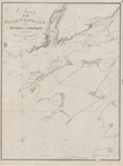
Lake Superior. Sheet 2 [1823-24, 1863]
Description
- Media Type
- Image
- Item Type
- Charts
- Description
- Chart of central Lake Superior. On the south shore the survey extends from west of Iron River to Sand River. On the north shore the survey runs from Grand Portage to the Slate Islands.
- Notes
- This edition adds a significant number of place names, including lights, fishing stations and Hudson Bay Company posts along with additional notes about local magnetic variations. From the American charts have been added insets for Ontonagon, Agate Harbour and Marquette.
- Inscriptions
- Lake Superior.
Sheet 2
The Soundings are in Feet
-- inset--
Ontonagon Harbour
From the United States Survey - 1859
Agate Harbour
From the United States Survey
1858
Marquette Harbour
From the United States Survey - 1859
--
(From the U. S. Survey of Lake Huron it is inferred that the Longitude of this Chart is about 10' in excess or too Westerly)
London Published according to Act of Parliament at the Hydrographical Office of the Admiralty, 1st Sept. 1828. Corrections to 1861. Nov'r 63
Sold by J. D. Potter Agent for the Admiralty Charts 31 Poultry & 11 King Street Tower Hill.
J. & C. Walker Sculpt - Publisher
- Great Britain. Admiralty. Hydrographic Office
- Place of Publication
- London, Eng.
- Date of Original
- pub. 1 Sept. 1828, Corrected to Nov. 1863
- Date Of Event
- survey: 1823-24, 1858-59
- Language of Item
- English
- Geographic Coverage
-
-
Michigan, United States
Latitude: 47.47074 Longitude: -88.05816 -
Ontario, Canada
Latitude: 47.8478895387719 Longitude: -88.098366859375 -
Michigan, United States
Latitude: 46.54354 Longitude: -87.39542 -
Michigan, United States
Latitude: 46.87105 Longitude: -89.31403
-
- Creative Commons licence
 [more details]
- Copyright Statement
- Copyright status unknown. Responsibility for determining the copyright status and any use rests exclusively with the user.
- Contact
- Maritime History of the Great LakesEmail:walter@maritimehistoryofthegreatlakes.ca
Website:

![Lake Superior. Sheet 2 [1823-24, 1863]](https://images.MaritimeHistoryoftheGreatLakes.ca/images/MHGL000122608.jpg)

