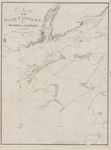
Lake Erie: West End [1864, 1898]
Description
- Media Type
- Image
- Item Type
- Charts
- Inscriptions
- North America
Lake Erie
West End
From the United States Coast Survey
1849
Soundings in feet
...
Note. The depth of water varies, according as the Seasons are
wet or dry, the maximum being from 2 to 3 ft.
--inset--
Kingsville Harbour
From a Canadian Government Survey 1895
Soundings in Feet
London Published at the Admiralty, 15 Sept. 1864, under the Superintendence of Capt'n G. H. Richards R. N. Hydrographer. Large corrections May 69; August 1890, April 1897. Feb. 1898.
Sold by J. L. Potter, Agent for the Admiralty Charts, 145 Minories.
Engraved by J. & C. Walker - Publisher
- Great Britain. Admiralty. Hydrographic Office
- Place of Publication
- London, Eng.
- Date of Original
- pub. 15 Sept. 1864; Corrections to Feb. 1898
- Date Of Event
- survey: 1849, 1898
- Language of Item
- English
- Geographic Coverage
-
-
Ontario, Canada
Latitude: 42.03759 Longitude: -82.73872 -
Ontario, Canada
Latitude: 41.7818610614662 Longitude: -83.0055432734375
-
- Creative Commons licence
 [more details]
- Copyright Statement
- Copyright status unknown. Responsibility for determining the copyright status and any use rests exclusively with the user.
- Contact
- Maritime History of the Great LakesEmail:walter@maritimehistoryofthegreatlakes.ca
Website:

![Lake Erie: West End [1864, 1898]](https://images.MaritimeHistoryoftheGreatLakes.ca/images/MHGL000122618.jpg)

