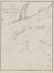
Georgian Bay: Cape Rich to Cabot Head [1890]
Description
- Media Type
- Image
- Item Type
- Charts
- Inscriptions
- Canada - Lake Huron
Georgian Bay
Cape Rich to Cabot Head
Surveyed by Staff Commander J. G. Boulton, R. N., assisted by Messrs. W. J.Stewat & D. C. Campbell, 1888,
under the orders of the
Government of the Dominion of Canada
Figures on the land express the heights in feet above the mean Summer surface of the Bay
Magnetic Variation in 1890; increasing 4' annually.
All bearings are Magnetic
Soundings in Fathoms
-- insets--
Lions Head Harbour
Owen Sound
McGregor Harbour
London. Published at the Admiralty, 9th July 1890, under the Superintendence of Captain W. J. L. Wharton R. N. F. R. S. Hydrographer.
Sold by J. D. Potter, Agent for the sale of Admiralty Charts, 145 Minories.
Engraved by Davies & Company - Publisher
- Great Britain. Admiralty. Hydrographic Office
- Place of Publication
- London, Eng.
- Date of Original
- pub. 9 July 1890
- Language of Item
- English
- Geographic Coverage
-
-
Ontario, Canada
Latitude: 45.240555 Longitude: -81.3 -
Ontario, Canada
Latitude: 44.71679 Longitude: -80.633 -
Ontario, Canada
Latitude: 45.0990865712974 Longitude: -81.12326515625 -
Ontario, Canada
Latitude: 44.9869 Longitude: -81.25866 -
Ontario, Canada
Latitude: 44.9275 Longitude: -81.029166 -
Ontario, Canada
Latitude: 44.569722 Longitude: -80.930555
-
- Creative Commons licence
 [more details]
- Copyright Statement
- Copyright status unknown. Responsibility for determining the copyright status and any use rests exclusively with the user.
- Contact
- Maritime History of the Great LakesEmail:walter@maritimehistoryofthegreatlakes.ca
Website:

![Georgian Bay: Cape Rich to Cabot Head [1890]](https://images.MaritimeHistoryoftheGreatLakes.ca/images/MHGL000122628.jpg)

