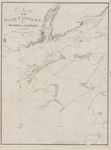
A Survey of Lake Erie [1817-18]
Description
- Creator
- Bayfield, Henry W., Surveyor
- Media Type
- Image
- Item Type
- Charts
- Inscriptions
- A Survey of
Lake Erie;
in the Years 1817 & 1818
By
Lieu't Henry W. Bayfield, R. N.
All Soundings are in feet
N.B. The depth of water varies, according as the seasons are wet or dry; the maximum being from two to three feet.
---insets---
Survey of Put In Bay
and the Adjacent Islands
--
Survey of Miamis Bay
--
Sketch
of the Mouth of the
Cayanoga [Cuyahoga] River
The waters of this River are said to approach within 5 or 6 miles of the waters which descend into the Ohio, and are navigable for boats near thirty miles.
--
Sketch
of the Mouth of the
River Segnan [Chagrin]
by Lieut H. W. Bayfield, R. N.
The bar shifts with every breeze and the entrance is sometimes completely blocked up.
--
Sketch
of
Grand River
About 3 miles up this River there is a Village called Paynville [Painesville] to which it is said to be navigable for boats.
Bar sometimes shut by the waves
--
Survey
of Presqu'Isle Harbour,
The United States' Naval Depot
London Published according to Act of Parliament at the Hydrographical Office of the Admiralty, 19th May 1828.
Sold by R. B. Bate Agency for the Admiralty Charts 21 Poultry
J. & C. Walker Sculpt
- Publisher
- Great Britain. Admiralty. Hydrographic Office
- Place of Publication
- London, Eng.
- Date of Original
- pub. 19 May 1828
- Date Of Event
- survey: 1817-18
- Language of Item
- English
- Geographic Coverage
-
-
Ohio, United States
Latitude: 41.67755 Longitude: -81.43761 -
Ohio, United States
Latitude: 41.51949 Longitude: -81.68874 -
Pennsylvania, United States
Latitude: 42.12922 Longitude: -80.08506 -
Ohio, United States
Latitude: 41.76032 Longitude: -81.28066 -
Ontario, Canada
Latitude: 42.1372380764912 Longitude: -81.3411145625 -
Ohio, United States
Latitude: 41.69949 Longitude: -83.45993 -
Ohio, United States
Latitude: 41.65838 Longitude: -82.81658
-
- Creative Commons licence
 [more details]
- Copyright Statement
- Copyright status unknown. Responsibility for determining the copyright status and any use rests exclusively with the user.
- Contact
- Maritime History of the Great LakesEmail:walter@maritimehistoryofthegreatlakes.ca
Website:

![A Survey of Lake Erie [1817-18]](https://images.MaritimeHistoryoftheGreatLakes.ca/images/MHGL000122588.jpg)

