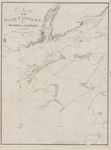
Lake Superior [1878]
Description
- Media Type
- Image
- Item Type
- Charts
- Inscriptions
- North American Lakes
Lake Superior
The Canadian Shore
from the Admiralty Survey by Lieut't H. W. Bayfield, r. N., 1823-5
The Coast and Plans of the United States
from the United States Government Surveys of 1855-72.
...
Magnetic Variation in 1883; Westerly increasing, Easterly decreasing about 4' annually.
All bearings are Magnetic.
Soundings in Fathoms
(reduced to the mean level of the Lake.)
London. Published at the Admiralty 20th Sept. 1878; under the Superintendence of Captain F. J. Evans, R. N. C. B. F. R. S. Hydrographer
Sold by J. D. Potter, Agent for the sale of the Admiralty Charts, 31 Poultry & 11 King St., Tower Hill.
Engraved by Davies & Company.
320 - Publisher
- Great Britain. Admiralty. Hydrographic Office
- Place of Publication
- London, Eng.
- Date of Original
- pub. 20 Sept. 1878
- Date Of Event
- survey: 1823-25, 1855-72
- Language of Item
- English
- Geographic Coverage
-
-
Michigan, United States
Latitude: 47.47074 Longitude: -88.05816 -
Michigan, United States
Latitude: 47.47129 Longitude: -87.8715 -
Minnesota, United States
Latitude: 46.78327 Longitude: -92.10658 -
Michigan, United States
Latitude: 47.45824 Longitude: -88.16233 -
Ontario, Canada
Latitude: 48.332222 Longitude: -87.098611 -
Michigan, United States
Latitude: 46.54354 Longitude: -87.39542 -
Michigan, United States
Latitude: 46.87105 Longitude: -89.31403 -
Michigan, United States
Latitude: 48.12071 Longitude: -88.5334 -
Wisconsin, United States
Latitude: 46.72077 Longitude: -92.10408
-
- Creative Commons licence
 [more details]
- Copyright Statement
- Copyright status unknown. Responsibility for determining the copyright status and any use rests exclusively with the user.
- Contact
- Maritime History of the Great LakesEmail:walter@maritimehistoryofthegreatlakes.ca
Website:

![Lake Superior [1878]](https://images.MaritimeHistoryoftheGreatLakes.ca/images/MHGL000122621.jpg)

